California Ranchos
During the two decades following Mexican Independence the northernmost reach of the Mexican State, named Alta California, was sparcely populated compared to any time before the Spanish conquest or after American colonization, which would come as a deluge starting in 1849.
In 1845, by events leading up to the annexation of Texas, it was likely clear to the governor of Alta California, Pío Pico, that the American armies would soon seize the northern lands of Mexico. During this year he quickly granted the prime California pasture lands in vast swaths of public land to petitioners, well represented by friends, family members, allies, and himself. The boundaries of these land divisions often loosely defined in coarse sketches of mountains and creeks .
Mexican Land Grants, recognized by the Treaty of Guadalupe Hidalgo, within twenty years of annexation would be mostly be bought by speculators from Europe and Connecticut, and the many arms of the Atchison, Topeka, and Santa Fe Railroad Company.
Just as the earlier Mission system of Spain pushed indigenous people to the rocky boundaries of the Southern California landscape, the American colonization would by 1870 create defacto domination across previously sparely-populated land. By the year 1900 dammed rivers and citrus grove subdivisions would trace the grid of a Southern California that a comtemporary reader would faintly recognize. After the dam building binge of the 1930s the natural spaces dried up and so did most life making a living on the outskirts of the water department.
As I have, you will find these names are still inscribed in many small places on roads broken and unbroken that connect modern tracted-Southern California. And as we trace roads and creeks we will start to discover the layered landscape that has always been right here under our feet.
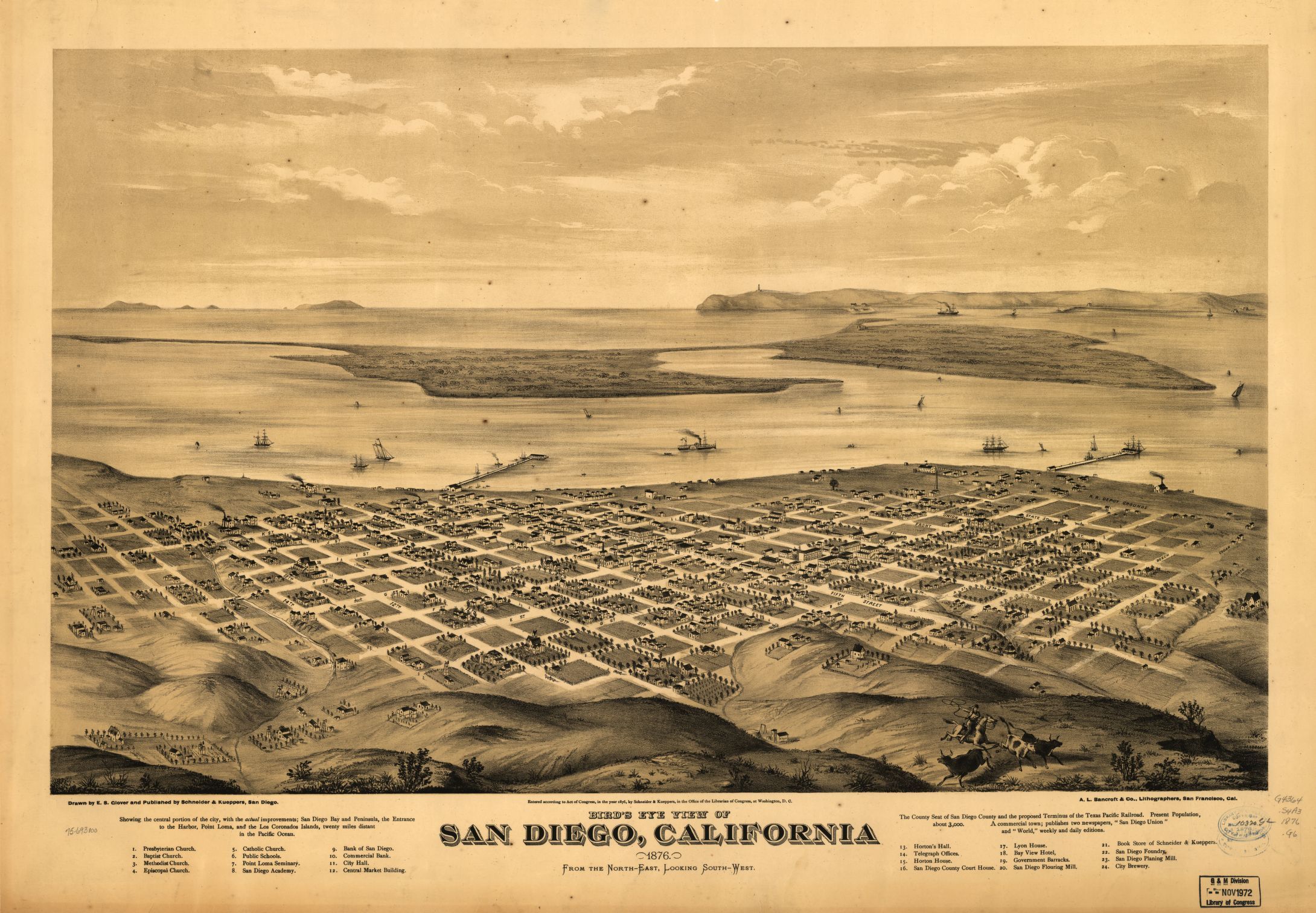
San Diego County
We begin our exploration starting with the southern most region of California, San Diego County.
Ranchos by Name
Rancho Milejo
Rancho Otay
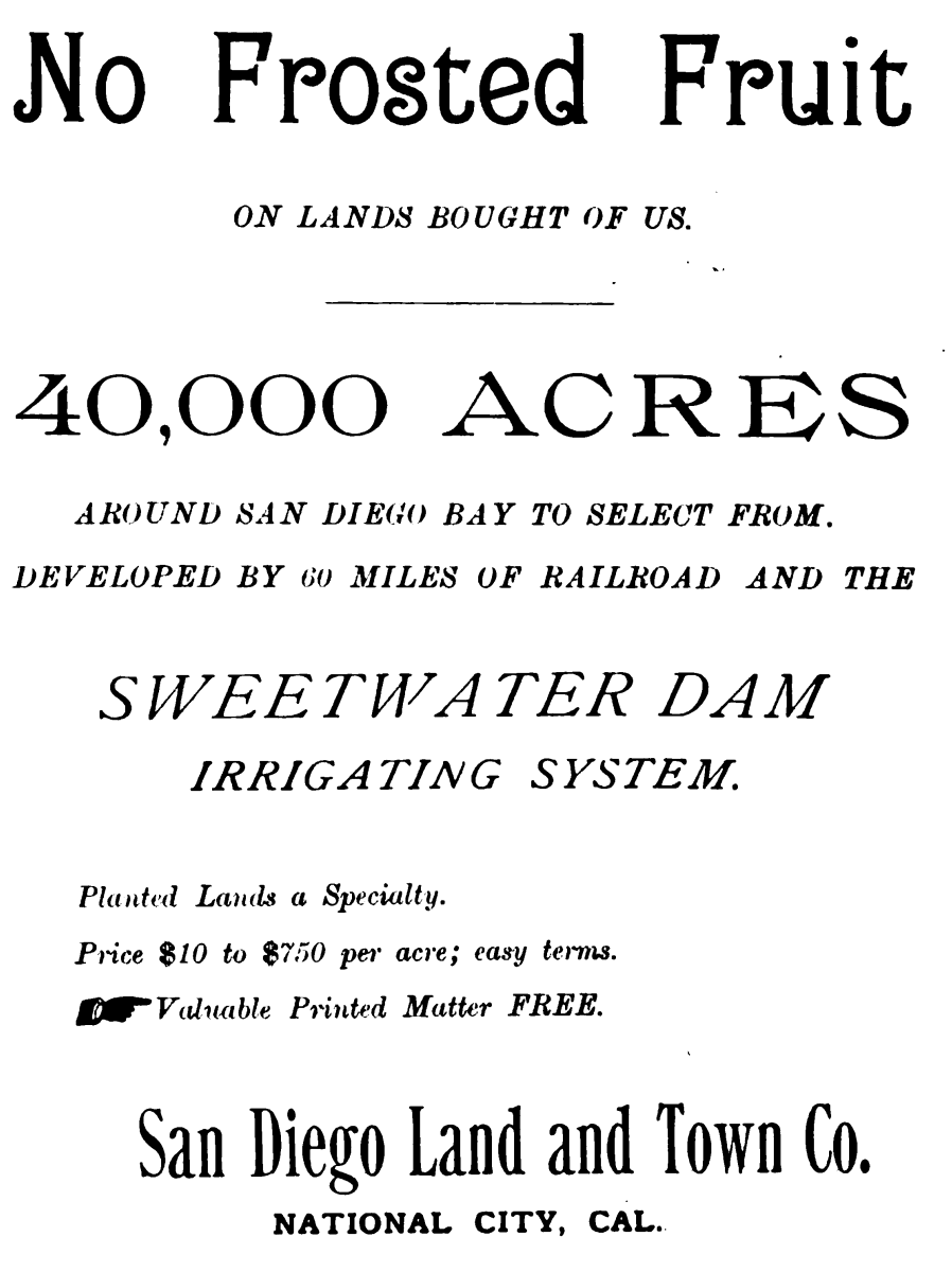
Rancho de la Nacion
Developed by Atchison, Topeka, and Sante Fe railroad off shoot named San Diego Land Development Company. See Sweetwater Dam. See "No Frosted Fruit".
Rancho Janal
Rancho Ex-Mission
Rancho El Cajon
Rancho Jamul
Rancho Cuyamaca
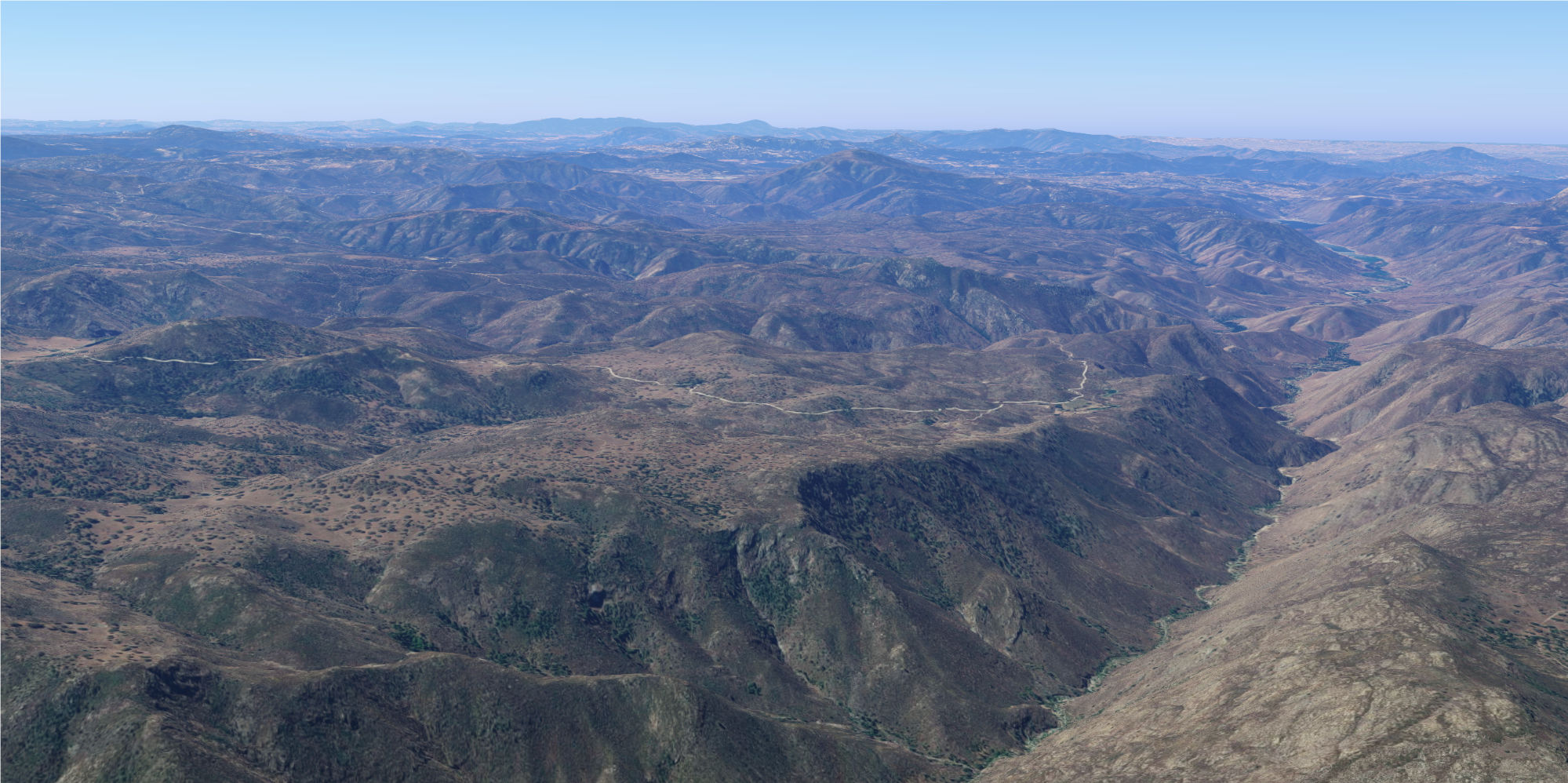
The most topographical of the land grants in San Diego County and once of the few remaining in public hands, albiet federal hands.
Rancho Valle de San Felipe
This rancho follows a tapered valley which funnels from the mountains to the desert below.
Rancho Santa Ysabel
Rancho Santa Ysabel in the valley with the present-day town sharing the same name at the junction of highways 78 and 79.Rancho Valle de Pamo
This valley has undergone many name changes and through suburbanization has preserved rural contours of the land and easements. See street names.
Rancho Cañada de San Vicente y Mesa del Padre Barona
Two lobes in one grant, the first name cañada is not submerged by reservoir of the same name. The second part, the mesa, is just to the east.
Rancho Ricon del Diablo
So named because is was near populations who had refused to be convert to Christianity, present-day Escondido.
Rancho Santa Maria de los Peñasquitos
Peñasquitos Canyon Preserve is the site of an important east-west passage along Poway-Peñasquitos Creek - while disrupted by subdivisions in the present-day city of Poway traces an old connection up the hill to the intersection of Poway Road and Route 67.
Waterways
We are completing a survey of miles of water used in the following applications.
Santa Ysabel Creek
Dams
Sutherland Reservoir Lake HodgesShopping Malls
Westfield at North CountyPreserves
- Santa Ysabel Nature Preserve (3 parts)
- xSan Dieguito Langoon State Marine Conservation Area
Golf Courses
- The Vineyard at Escondido*
- xThe Crosby Club at Rancho Santa Fe
- xMorgan Run Club and Resort
- Fairbanks Ranch Country Club